
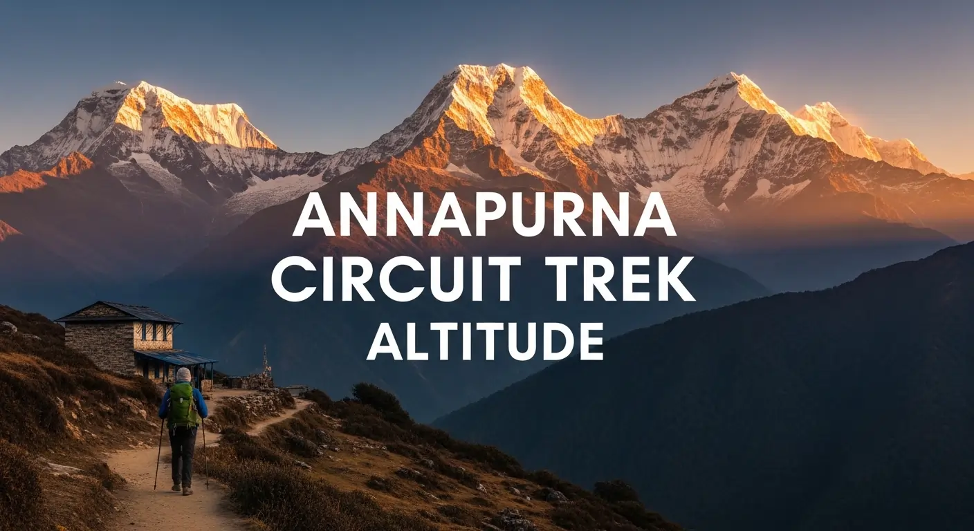
What is the Annapurna Circuit Trek Altitude? Complete Guide
The Annapurna Circuit Trek reaches its highest point at Thorong La Pass, which sits at an elevation of 5,416 meters (17,769 feet). The journey begins in the lush subtropical valleys around Besisahar at approximately 760 meters, meaning trekkers experience a staggering total elevation gain of over 4,600 meters throughout the circuit. This transition from low-altitude forests to the high-alpine environment of the Mustang region is what makes the trek both physically challenging and visually spectacular.
Successfully navigating the Annapurna Circuit Trek altitude requires a methodical approach to acclimatization, particularly as you cross the 3,000-meter threshold. The route is strategically designed to follow the “climb high, sleep low” principle, with essential rest days in villages like Manang (3,540m) to help the body adjust to the decreasing oxygen levels. Whether you are trekking through the deep forests of Chame or standing atop the windy Thorong La Pass, understanding the elevation profile is the first step in preparing for this legendary Himalayan loop.
Introduction to the Annapurna Circuit Trek
The Annapurna Circuit Trek altitude ranges from 760 meters at the start to a peak of 5,416 meters at Thorong La Pass, making elevation the primary challenge and the defining feature of the journey. This classic trek circles the massive Annapurna Massif, traversing diverse climate zones from subtropical jungles to high-altitude Himalayan deserts. Because the route crosses the “thin air” threshold early in the itinerary, understanding the altitude profile is essential for every trekker aiming to successfully complete this 160-to-230-kilometer loop.
Altitude is the single most important factor on this trek because it dictates the pace of the journey and the biological limits of the human body. When considering trekking in nepal for beginners, it’s vital to realize that as you ascend, the decreasing atmospheric pressure means there is significantly less oxygen available with every breath, making your lungs feel like they’re trying to breathe through a cocktail straw, requiring a slow, disciplined approach to prevent Acute Mountain Sickness (AMS). The elevation profile is characterized by a steady gain over several days, peaking at the legendary Thorong La Pass before dropping into the arid Mustang region, providing a physical test that rewards trekkers with some of the most dramatic mountain vistas on Earth.
What Is the Annapurna Circuit Trek Altitude?
The Annapurna Circuit Trek altitude reaches its maximum height at the summit of Thorong La Pass, which stands at 5,416 meters (17,769 feet). This iconic journey begins at a modest elevation of roughly 760 meters in the lush lowlands of Besisahar, resulting in a total elevation gain of over 4,600 meters as you transition through various ecological zones. Because the trek involves crossing into the “extreme altitude” category, proper acclimatization is essential to prevent altitude-related illnesses; the body requires strategic rest days and a slow ascent rate to adapt to the significantly lower oxygen levels found at the pass, where the atmospheric pressure is nearly half of that at sea level.
Annapurna Circuit Trek Altitude Overview
The Annapurna Circuit Trek altitude profile is a dramatic journey that begins at 760 meters and climbs steadily to a peak of 5,416 meters, representing one of the most diverse elevation gains in the Himalayas. This progression takes trekkers through varied landscapes, from subtropical forests to high-alpine environments, and often leads people to wonder, how difficult is Annapurna circuit trek? Understanding these specific elevation stages is the most important part of planning, as it allows for a safe and successful crossing of the highest point on the circuit without feeling like your lungs have gone on strike.
Starting Point Altitude
The trek typically begins at Besisahar, which sits at an elevation of approximately 760 meters (2,493 feet). Starting at this relatively low altitude allows your body to begin the journey in a oxygen-rich environment, providing a gentle introduction before the steep climbs ahead. From here, the trail follows the Marsyangdi River valley, where the air is warm and the surroundings are lush, giving trekkers a few days to find their rhythm before the environment shifts toward the colder, thinner air of the upper Manang region.
Gradual Altitude Gain Along the Route
As the trek progresses, the gain in altitude is managed through a series of overnight stays in high-altitude villages like Chame (2,670m) and Pisang (3,200m). This slow ascent is vital, as it allows your respiratory and cardiovascular systems to gradually adapt to the decreasing atmospheric pressure. The route is designed so that you rarely gain more than 400 to 500 meters of sleeping elevation per day once you cross the 3,000-meter mark, adhering to global safety standards for high-altitude trekking and ensuring that your body stays ahead of the acclimatization curve.
Highest Point of the Trek
The ultimate challenge and the highest point of the Annapurna Circuit Trek altitude is the Thorong La Pass, standing at a formidable 5,416 meters (17,769 feet). Crossing this pass is a monumental achievement that requires a pre-dawn start from Thorong Phedi or High Camp to avoid the high-velocity winds that typically pick up by mid-day. Reaching the summit of the pass rewards trekkers with prayer flags, a small tea shop, and an unparalleled panoramic view of the Annapurna and Dhaulagiri massifs before a steep 1,600-meter descent into the sacred valley of Muktinath.
Annapurna Circuit Trek Altitude Breakdown by Major Stops
The Annapurna Circuit Trek altitude breakdown is a methodical journey that begins at 760 meters and reaches an extreme altitude of 5,416 meters at Thorong La Pass, crossing through subtropical, alpine, and arctic climate zones. This progression is carefully mapped to allow for safe acclimatization, moving from the lush river valleys of the Marsyangdi to the high-altitude desert of the Mustang region. Because the weather at these heights can be as temperamental as a cat in a bathtub, picking the best time to trek annapurna circuit is crucial for a smooth journey. Understanding the elevation gain at each major stop is the key to managing your energy and ensuring your respiratory system adapts to the thinning air before the final crossing.
| Trekking Section | Altitude Range (Meters) | Altitude Range (Feet) | Key Altitude Milestone & Highlight |
| Besisahar to Chame | 760m – 2,670m | 2,493ft – 8,760ft | Entry into the Annapurna region; transition from subtropical heat to cooler mountain air. |
| Chame to Manang | 2,670m – 3,540m | 8,760ft – 11,614ft | Crossing the 3,000m “thin air” threshold; significant shift to alpine landscapes and pine forests. |
| Manang to Thorong Phedi | 3,540m – 4,450m | 11,614ft – 14,600ft | Critical acclimatization zone; vegetation thins as you enter the high-alpine tundra and yak pastures. |
| Thorong Phedi to Thorong La | 4,450m – 5,416m | 14,600ft – 17,769ft | The ultimate ascent to the highest point; atmospheric pressure drops to roughly 50% of sea level. |
| Thorong La to Muktinath | 5,416m – 3,760m | 17,769ft – 12,335ft | A steep 1,656m descent; rapid transition into the arid, rain-shadow landscape of the Mustang district. |
How Does the Annapurna Circuit Trek Altitude Affect Trekkers?
The Annapurna Circuit Trek altitude affects trekkers by subjecting the body to significantly lower atmospheric pressure, which reduces the amount of oxygen available with every breath. Above 3,000 meters, the body must work harder to perform basic functions, essentially making your heart beat like a drum at a rock concert, leading to an increased heart rate and faster respiration. To stay comfortable while your body does all this heavy lifting, having the right Annapurna circuit trek packing list is vital for layering up against the chill. If a trekker ascends too quickly without allowing their blood chemistry to adapt, they face a high risk of altitude-related illnesses, making physiological awareness the most critical skill for a successful crossing.
Altitude Sickness Risks
Acute Mountain Sickness (AMS) is the primary risk when navigating the high-altitude sections of the Annapurna Circuit. Symptoms often start as a mild headache, dizziness, or loss of appetite, but can quickly escalate into more severe conditions like High Altitude Pulmonary Edema (HAPE) if ignored. Recognizing these early warning signs is vital for survival; the standard protocol is immediate rest or descent, as pushing through symptoms at heights above 4,000 meters can lead to rapid physical deterioration and life-threatening complications.
Importance of Acclimatization Days
Strategic rest days, particularly in the village of Manang (3,540m), are a non-negotiable part of the Annapurna Circuit itinerary. These days allow the body to produce more red blood cells and adjust its pH levels to better transport the limited oxygen available in the atmosphere. Instead of passive rest, trekkers often “climb high and sleep low” by taking short day hikes to higher viewpoints like Ice Lake or the Gangapurna Glacier, which stimulates the acclimatization process while ensuring the body recovers at a lower, safer elevation overnight.
Oxygen Levels at High Altitude
As you climb above the 4,000-meter mark toward Thorong Phedi and Thorong La Pass, the effective oxygen level drops to approximately 50% to 60% of what is available at sea level. This drastic reduction means that even simple tasks, such as tying your boots or packing a bag, can leave you feeling winded and exhausted. The lack of oxygen also affects sleep quality and cognitive function, making it harder to make clear decisions during the final, cold ascent to the 5,416-meter pass where the air is at its thinnest.
Annapurna Circuit Elevation Profile and Distance
The Annapurna Circuit Trek covers a total distance of approximately 160 to 230 kilometers (100 to 145 miles), with a massive net elevation gain of over 4,600 meters from the start to the highest point. This elevation profile is characterized by a long, steady ascent through the Marsyangdi River valley followed by a rapid, knee-jarring descent into the Kali Gandaki Gorge. Understanding the relationship between daily mileage and vertical gain is crucial for pacing yourself across the diverse terrain of the Annapurna Massif.
Total Trek Distance and Altitude Gain
The total distance of the Annapurna Circuit varies depending on where you choose to start and end your trek, as road construction has modified the traditional route. On average, trekkers cover about 10 to 15 kilometers per day while climbing from the humid lowlands at 760 meters to the arctic environment of Thorong La at 5,416 meters. This results in a staggering cumulative altitude gain that tests your cardiovascular endurance, as you transition from lush sub-tropical forests to the high-altitude desert landscapes of the Mustang region.
Daily Walking Distance and Elevation Changes
A typical day on the circuit involves walking for 5 to 7 hours, with an average daily elevation gain of 400 to 600 meters. While the lower sections feature longer walking distances on relatively gentle slopes, the distances often shorten as you climb higher to allow your body time to acclimatize to the thinning air. These daily changes are strategically planned to ensure that you arrive at your evening teahouse with enough energy to recover, balancing the physical “wear and tear” of the trail with the biological needs of your respiratory system.
Key High-Altitude Sections of the Trek
The most critical high-altitude sections begin once you leave the village of Manang (3,540m) and head toward the high camps. The trail between Yak Kharka (4,050m) and Thorong Phedi (4,450m) is where most trekkers first truly feel the impact of reduced oxygen, with the final 1,000-meter push to Thorong La being the most physically demanding part of the journey. Navigating these sections requires a slow, rhythmic pace and a deep focus on hydration, as the terrain becomes a high-alpine wilderness where every step upward requires significantly more effort than at lower elevations.
Best Acclimatization Tips for the Annapurna Circuit Trek
The best way to acclimatize on the Annapurna Circuit is to follow the “climb high, sleep low” rule and maintain a slow, steady pace that never exceeds an average daily elevation gain of 500 meters. Proper acclimatization is a biological process that cannot be rushed, as your body needs time to adjust its blood chemistry to the decreasing oxygen levels. By combining a conservative ascent schedule with proactive health habits, you can significantly reduce the risk of altitude sickness and ensure a successful crossing of Thorong La Pass.
- Ascend Gradually: Maintain a “Pole-Pole” (slowly, slowly) pace and avoid gaining more than 300–500 meters of sleeping elevation per day once you cross 3,000 meters to allow your red blood cells to catch up with the thinning air.
- Prioritize Hydration and Nutrition: Drink at least 3 to 4 liters of water daily and consume high-calorie, carbohydrate-rich meals to fuel your body’s increased metabolic demands at high altitudes.
- Respect the Rest Days: Use scheduled stops in villages like Manang (3,540m) for active recovery hikes to higher viewpoints, which stimulates your system without the strain of carrying a full pack to a new sleeping altitude.
- Listen to Your Body: Never ignore a persistent headache or nausea; communicate openly with your team and be prepared to stay an extra night or descend if symptoms of Acute Mountain Sickness (AMS) do not improve.
- Hire Experienced Guides: Professional guides provide an essential safety net by monitoring your heart rate and oxygen saturation daily, helping you make informed decisions based on your actual physiological performance.
Conclusion
Navigating the Annapurna Circuit Trek altitude is a journey of both physical endurance and biological adaptation. While the 5,416-meter summit of Thorong La Pass remains the ultimate goal, the true success of the trek lies in the disciplined days of acclimatization leading up to it. From the tropical heat of the lower valleys to the thin, frozen air of the high-alpine desert, this trek offers a unique opportunity to witness the full spectrum of the Himalayan landscape. By respecting the elevation profile and following a professional itinerary, trekkers can turn a potentially dangerous ascent into one of the most rewarding achievements of their lives.
Standing atop the pass, surrounded by the towering peaks of the Annapurna and Dhaulagiri massifs, the thin air becomes a testament to your resilience. Whether you are a seasoned trekker or a first-timer in the Himalayas, the Annapurna Circuit remains the gold standard for high-altitude trekking. As long as you listen to your body, stay hydrated, and pace yourself correctly, the “Roof of the World” is well within your reach.
Ready to Conquer Thorong La Pass?
Don’t leave your high-altitude safety to chance. Marvel Treks provides the most comprehensive altitude-management support in the Himalayas, combining veteran guide expertise with medical-grade monitoring to ensure you cross the pass with confidence.
FAQS
What is the maximum Annapurna Circuit Trek altitude?
The maximum altitude reached on the Annapurna Circuit is 5,416 meters (17,769 feet) at the summit of Thorong La Pass. This point marks the highest elevation of the entire trek and serves as the geographical divide between the Marsyangdi and Kali Gandaki valleys.
Is the Annapurna Circuit Trek altitude dangerous?
While the altitude is high enough to cause Acute Mountain Sickness (AMS), it is not inherently dangerous if trekkers follow a proper acclimatization schedule. Most incidents occur when trekkers ignore early symptoms or ascend too rapidly. With a slow pace and rest days, the vast majority of trekkers cross the pass safely.
How many meters do you climb each day on the circuit?
Once above 3,000 meters, a safe itinerary typically involves gaining only 300 to 500 meters of sleeping altitude per day. While you may hike higher during the day for acclimatization (climb high, sleep low), your overnight stops are spaced out to ensure your body can adjust to the decreasing oxygen levels.
Do I need supplemental oxygen for the Annapurna Circuit?
No, supplemental oxygen is not used or required for the Annapurna Circuit Trek. The body is capable of acclimatizing to 5,416 meters naturally through a gradual ascent. However, professional guides often carry emergency oxygen cylinders to assist trekkers who may suffer from severe altitude sickness during the crossing.
What are the symptoms of altitude sickness on this trek?
Common symptoms include a persistent headache, nausea, loss of appetite, dizziness, and difficulty sleeping. If you experience these at high-altitude stops like Manang or Thorong Phedi, it is vital to stop ascending immediately. Most mild cases resolve with a rest day or a slight descent.
Why is a rest day in Manang (3,540m) necessary?
Manang is the critical threshold where the air becomes significantly thinner, and a rest day there allows your blood to produce more red cells. It is the last major village before the final push to the pass, making it the ideal “staging ground” for your body to finalize its primary acclimatization.
Is there a risk of altitude sickness after crossing the pass?
The risk drops significantly once you descend to Muktinath (3,760m), but you should still remain hydrated. Because you drop over 1,600 meters immediately after the pass, most trekkers feel an “oxygen high” and an instant relief from any mild altitude symptoms they felt on the ascent.
Can I take Diamox for the Annapurna Circuit Trek altitude?
Many trekkers use Diamox (Acetazolamide) as a preventive measure to speed up acclimatization, but it should be discussed with a doctor first. While it helps your body adjust more quickly, it is not a substitute for a slow ascent and should not be used to mask worsening symptoms of altitude sickness.
Ready for your next Himalayan adventure?
Plan Your Next Big Adventure with Us
Explore Our AdventuresJoin our expert-guided journeys across Nepal and beyond, from classic trails to epic summits.